2008-08-23

May 31, 2008: Grosmont to Robin Hood’s Bay

May 31, 2008

Grosmont to Robin Hood’s Bay

(25.0 km; 9 hrs 22 min; 744 m ascent; 780 m descent)

Google Map

Grosmont station

The last day of the walk! It was a very strange feeling. We were awoken at 7:30 am by the sound of steam engines, but didn’t get up for a while. Breakfast was at 8:30 am, cereal and toast and a cooked English breakfast, which we ate some of. We said our goodbyes to our hosts and walked down to the station, where Neil and Christine were to meet us at 9 am. As we were watching the trains, Neil phoned from Egton Bridge. Their scheduled taxi hadn’t shown up, so he said we should go on without them. We said no, we would watch the trains until they arrived. As we were arguing the point, their taxi arrived, and in ten minutes they were in Grosmont.

The first steam trip was scheduled for 9:30 am, so we watched it puff its way down the track and then we were off. Up the steep main street of Grosmont, to start with. But then it turned steeper, with signs warning of the 33% grade. This went on forever. Finally we were out of the farms and onto Sleight’s Moor.

Littlebeck

The weather was sunny with almost no clouds, and from here we had our first real view of the North Sea. Coming down from the moor we dropped quite steeply to Littlebeck, a very beautiful little cluster of houses. We stopped for a rest there, then entered Littlebeck Wood. Our guide book described this as possibly the best part of the Coast-to-Coast, and it certainly didn’t disappoint us. The trail followed the beck through a dappled forest filled with wild garlic and a lot of other flowers.
Littlebeck Wood

Our next stop was Falling Foss, where we decided to stop and have lunch. We did that outside Midge Hall, and talked to its new owners, who were planning to bring it back from its previously ruined state. The house and garden already looked liveable, and the owner said they planned to set up a little hydroelectric plant to provide power, and to open a tea garden within the next month. No tea was forthcoming today, however.

So far our last day’s walk was very lovely, but we still had a long way to go. We continued along May Beck, then met a road, which we followed for a while before crossing Sneaton Low Moor and the Graystone Hills. Some parts of the moor were a bit boggy, but nothing compared to what they could have been like if it had been raining. Here we were a bit confused by the book’s directions, but with the help of the GPS waypoints and the Ordnance Survey map, we climbed a gate and carried on. We were lucky with the weather, so we had great views of the North Sea getting closer and closer.

Whitby and the North Sea

All of us were dreaming of cream tea and toilets, so when we saw a little sign for the York House Hotel in High Hawsker mentioning cream teas, we were in there like a shot. The cream tea was delicious, with lots of double cream and jam on a raisin scone. We would have rated it Number One in our Coast-to-Coast cream tea survey, but in fact it was the only cream tea we had found.

The toilet, on the other hand, was rather eccentric. On the door it said “Temporary Public Toilet.” Inside there was (luckily) a toilet, but besides that there was a bathtub containing a big dolls’ house and a shower stall containing 50 rolls of toilet paper and an unexplained metal box. However, the hotel had only been open for a week and it didn’t seem to have many occupants.

After numerous cups of tea we set off for the final leg of our journey. Our route was through some fields and down through a caravan site, and then it rejoined the Cleveland Way as it ran along the cliff tops. There were great views, with gulls and kittiwakes flying by, and at one place we watched a group of gulls harassing a seal with a fish in its mouth. It seemed to take quite a while, but it was only an hour or so later that we finally arrived in the impossibly quaint village of Robin Hood’s Bay.

Almost there!

We hobbled down the impossibly steep main street and made our way to the beach. Luckily the tide wasn’t too far out. We dipped our boots in the North Sea and then threw in the pebbles we had carried all the way from St Bees. We had done it, we had walked across England! It hadn’t seemed like much when we were doing it, because it just required putting one foot in front of the other. But all those steps did add up to a significant achievement. They also added up to Paul’s sore heels and Rosemary’s sore knees, but those are only temporary.

On the cliff path

Back in the town we met up with Neil and Christine, who had by now caught us up. We decided to order a wooden plaque to be made and shipped to us, then we all went to the takeaway to line up for fish and chips, which were very good. Neil and Christine went to get their car, and we walked just a bit farther along the cliff path, to the Boggle Hole youth hostel which was our final destination. It is in an interesting location, down in a narrow valley close to the sea. We checked in and then had showers. There was no Internet terminal for public use, but the manager on duty very kindly let us use their computer to send a couple of e-mails.
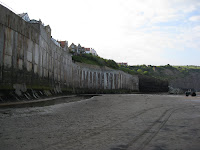
On the beach at Robin Hood’s Bay

Neil and Christine finally arrived, after circling the town looking for petrol, only to find that the Packhorse company had not delivered their bag. Apparently carrying bags down from the parking lot is not in the contract, so they had left it at the taxi company’s office in Robin Hood’s Bay. Neil grumpily headed back to retrieve the bag while Christine had a shower. We sat in the lounge and wrote our journals. Bed time was later tonight, but we would sleep well after our long trip. Tomorrow we will not be walking—a strange concept indeed!

Elevation profile:
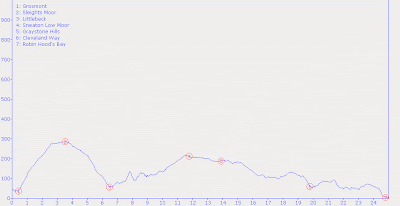
(click to enlarge)

May 30, 2008: Blakey Ridge to Grosmont

May 30, 2008

Blakey Ridge to Grosmont

(22.0 km; 6 hrs 52 min; 239 m ascent; 594 m descent)

Google Map

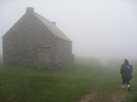
Trough House in the mist

Last night, after the noise from the bar died down, we were woken up a couple of times by heavy winds. And when we got up in the morning the wind was still blowing hard from the east. What was surprising was that the inn was shrouded in clouds! We met Christine and Neil for breakfast at 8:30 am, keeping out of the argument between another Coast-to-Coast party and the management about why they couldn’t get breakfast earlier. We had our usual breakfast, but breaking with tradition, Rosemary also had scrambled eggs and Paul had kippers.

Arncliffe Arms, Glaisdale

By the time we had eaten, got ourselves organized, and checked out, it was 9:30 am. The start of our walk was uphill beside the road. Luckily there wasn’t too much traffic as the visibility was not very good. After a while we turned off onto a bridleway, and from there the route was across the moors, mostly on roads both paved and unpaved. At each major turning point we checked the book, the GPS, and the Ordnance Survey map to make sure we were heading in the correct direction. Along the route we passed several large stone navigational markers with names like “Fat Betty” and, of course, there were lots of sheep. But there weren’t any birds singing in the mist.

Beggar’s Bridge

Around noon we started to encounter breaks in the mist, mostly because Glaisdale Rigg was leading us down to lower elevations. Now the skylarks started flying, and by 1:30 pm we were off the moor and into the village of Glaisdale, back in farm country. We stopped at Ford’s Butcher Shop, where Christine bought some meat pies for lunch, then continued down to the Arncliffe Arms. Luckily it was still open to buy some tea. We sat inside and ate our lunch, which was a nice break from the wind.

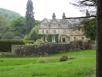
Egton Manor

Downhill even more was the Beggar’s Bridge, which comes with a romantic story as its background. By now we didn’t have much farther to walk, so we dawdled along through a lovely forest beside the river, ending up in Egton Bridge where Neil and Christine were staying at the Horseshoe Hotel. Christine stayed there to relax while Neil carried on the remaining 30 minutes along an old toll road to Grosmont with us.

Grosmont House

Grosmont is home to the North Yorkshire Moors Railway, so upon our arrival what should we see but the steam engine featured in the Harry Potter movies and the Heartbeat television series. Neil left us at the station and caught the (modern) train back to Egton Bridge while we lingered a bit, looking at the trains. Our B&B, Grosmont House, was uphill from the station so we had a steep climb before getting there. It was a large 19th-century house with 10-foot ceilings and spacious rooms, and the owners were very welcoming. We made a cup of tea, then decided to forego our showers so that we could explore the village and watch the trains.

Sir Nigel Gresley at Grosmont

Once we had exhausted the sights, we headed back to the B&B. Basically the only place in the village for dinner was the Station Tavern, which was of course next to the station. It didn’t open for dinner until 6:30 pm, so a little after 6 pm we headed back down to watch the trains. One of the engines at the station was the Sir Nigel Gresley, which had set a post-war speed record of 112 miles per hour. At the tavern we met the two young American guys who we remembered from Osmotherly, so we sat and chatted while waiting for our meals. Paul had steak pie and Rosemary had lasagna, which she said was the best lasagna she had had on the trip. After dinner we headed back to the B&B to have baths and write our journals.

Elevation profile:

(click to enlarge)

May 29, 2008: Osmotherley YH to Blakey Ridge

May 29, 2008

Osmotherley YH to Blakey Ridge

(31.0 km; 9 hrs 33 min; 1056 m ascent; 829 m descent)

Google Map

Today was going to be our longest day since the first day of the walk. If it were a stage of the Tour de France, it would be the “queen stage”: very long with plenty of climbing. Neil had looked at the Ordnance Survey map, and he said there would be four ups and downs before we got onto the moors.

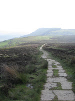
Paved path across the moor

After breakfast (cereal and toast) we set off at 8:35 am. Neil had suggested that we should walk as separate parties, we being faster walkers than them, so there was just the two of us. We started up a bridleway which would lead us to the Cleveland Way. The early-morning clouds had burned off and it was quite warm, but in the valley below us it was still slightly misty. Within half an hour we had reached the Cleveland Way, which we were to follow for most of the day. It went through the forest and then plunged steeply down towards Swainby.

The next uphill section took us through a lovely forest scattered with bluebells and wild garlic. The walk was very enjoyable so far and it was nice to know that we were checking off the ups and downs. At the bottom of the next downhill we crossed the road at Huthwaite Green, stopping to chat with three men who were going out for a walk. We left them still getting organized while we started on our next uphill. This one started out well but soon turned a corner and took us straight up a stone-lined path onto Live Moor. The walk across this moor was very scenic and luckily the mist had cleared, so the views into the valleys were good.

Lord Stones Café

Once again we dropped down and climbed up, and before we knew it we were up on Carlton Moor. Then we dropped down very steeply to the road and the Lord Stones Café, a busy underground establishment where we bought ice cream bars for ₤1 each. Half an hour later we ate lunch at the seat installed in memory of Alec Falconer (“Rambler”), a long-time walker of the area. From this seat the views over north-eastern England were terrific so it was enjoyable just sitting there.

View from Falconer Seat

We finally decided to carry on, and as we left we could see Christine and Neil working their way up the hill to the seat. Just after that we met a group of local walkers who told us there were actually six hills to climb over, not four. This was not good news. The next big climb was up to the Wainstones, where we went left of them instead of through them and found ourselves traversing a heather-covered cliff. But scrambling up to the top put us back on course. The path was paved with large blocks and was easy to walk on, but once again it plunged steeply downwards to the Clay Bank Top road.

The Wainstones

The next (and final) climb was a real killer, as we had forgotten to refill our water bottles at Lord Stones and we were quite thirsty. But Paul found an apple in a corner of his pack, which made an amazing difference. We set off straight across the moor on a wide sandy track. It was still sunny but there was a bit of a breeze to cool us off. Now it was much easier going but there was still a long way to go. We saw a flock of Red Grouse with a dozen or more tiny chicks. Later we saw more grouse and a few Golden Plovers. This path went on for about an hour, after which the Cleveland Way turned off to the left and we continued straight ahead. After another long while we turned off onto an old railway grade which ran across the high moor.

Red Grouse

By now it had clouded over and with the breeze it was rather chilly. But we persevered and after another long while the roofs of the Lion Inn appeared, looking rather like a Tibetan monastery, and just after 6 pm we were there. The Lion Inn is no monastery, though, it is a popular roadhouse. The car park was full and there was a line-up at the bar. We threaded our way through the crowd and checked in. We had booked their cheapest room (₤19 per person), which was upstairs. (“Watch Your Head.”) There were twin beds and just enough room to stand up, but that was fine.

Lion Inn, Blakey Ridge

After having our showers we went down to dinner. We shared a giant Yorkshire pudding as an appetizer, and for the main course we both had Barnsley lamb chops which came with chips, peas, and a small salad. The chops were excellent, but trying to eat them tended to scatter the chips and peas all over the place. Especially after a pint of Old Peculier. Both of us were stuffed by the time we were finished. Neil and Christine arrived just as we were being served, just as tired as we were. Back in our room we wrote our journals and went to bed early.

Elevation profile:

(click to enlarge)

May 28, 2008: Danby Wiske to Osmotherley YH

May 28, 2008

Danby Wiske to Osmotherley YH

(19.8 km; 6 hrs 11 min; 342 m ascent; 214 m descent)

Google Map

We had our usual porridge and toast for breakfast, but this time we got some extra toast to use as lunch makings because there was no shop in Danby Wiske. Last night we had heard a couple of showers on our skylight, and as we ate our breakfast it was raining quite hard. So when Christine and Neil arrived, we put on our Gore-Tex before heading out.

We set out walking on the flat roads and paths of the Vale of Mowbray, but the rain had stopped and it never started again. Today’s walk was much like yesterday’s through farming country. Most of the farms were grain farms, and it took a couple of hours before we came to our first sheep. The clouds were quite low, so we didn’t really get any good views towards the Cleveland Hills ahead of us.

The A19

Shortly after noon we came to the notorious crossing of the A19. We bought some tea at the trucker’s café there and ate our lunch at the picnic tables outside. By now the clouds were lifting and we could see the Cleveland Hills, which were our next barrier to cross. We risked our lives dashing across the road—fortunately there was a median in the middle—and carried on through Ingleby Cross and Ingleby Arncliffe.

Our route now followed a forest road up quite steeply through the Arncliffe Forest, soon joining on to the Cleveland Way, which led down to the village of Osmotherley, where our youth hostel was located. We followed the road down into the village, and then realized that was not the way to the hostel. But we did some lunch shopping at the village shop, where we asked for the correct way. Back up the hill we went, then down another hill in the opposite direction to the hostel. This building used to be a flax mill, so from the outside it looked very utilitarian. Upon arrival we found we could not check in until 5 pm, so we left our packs and walked back to the village to look around and also to buy more ibuprofen for Rosemary’s knee.

Row houses in Osmotherley

Checking in at the hostel, we found that our reservations for dorm beds had been changed into a reservation for a twin room. We unpacked and had showers. Dinner was at 7 pm. Paul had sausages and mash and Rosemary had beef cobbler, and both of us had apple crumble for dessert. Bedtime was early, at 9:30 pm.

Elevation profile:

(click to enlarge)

May 27, 2008: Richmond to Danby Wiske

May 27, 2008

Richmond to Danby Wiske

(21.6 km; 6 hrs 37 min; 216 m ascent; 282 m descent)

Google Map

The eating area of the Old Brewery was in their main house (our room was two doors up the street) and was a lovely room with an outside sitting area in the garden. This morning it was quite cloudy and it looked as if it might have rained a little bit overnight. We hoped this was not going to be today’s weather. The room was crowded and we took the last two seats. After our usual porridge and toast we went back to our room to finish packing.

Neil and Christine arrived about 9 am and we paid our bill and set out. It was indeed raining slightly outside, so we dressed accordingly. The path took us over the bridge and onto a path alongside the Swale River. The rain wasn’t heavy and at this point we were walking under trees for the most part. Before long it stopped completely. Our route followed pathways and roads for most of the day, with today scheduled to have the longest stretch of road-walking on the whole Coast to Coast.

St Mary’s, Bolton-on-Swale

At lunch time we stopped in Bolton-on-Swale, hoping for a pub or a tea shop, but alas, none was to be found here. So we sat in the porch of St Mary’s Church to eat our lunch. In this churchyard was the grave of Henry Jenkins, who was reputed to be 169 years old when he died.

While we had been eating lunch it had been raining, but it stopped before we left. From Bolton-on-Swale we followed roads, through fields of grain rather than sheep or cattle. There wasn’t much to see here, so we just kept putting one foot in front of the other until just before 4 pm we came into Danby Wiske and our resting spot, the White Swan Inn, a very lovely old pub. Neil and Christine were staying elsewhere, but they had put their list into the bag that was being transported for them and they didn’t quite remember where. But Danby Wiske is a small place, so that was easily remedied by asking around a bit.

White Swan Inn, Danby Wiske

Our room was up at the top of the stairs under the roof. We rinsed out some clothes and had showers and generally tidied up. Then we went downstairs to sit in the pub. Christine and Neil returned at about 7 pm and we ordered our dinners. It took quite a while for the food to arrive but once it did, we all thought it worth the wait. Paul had beef hotpot and Rosemary had chicken and mushroom casserole, with extra vegetables. The latter turned out to be a huge plate of good quality vegetables, so we shared it among us. After that meal we were stuffed.

Then back to our room, to bed at 10 pm.

Elevation profile:

(click to enlarge)

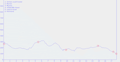
May 26, 2008: Grinton YH to Richmond

May 26, 2008

Grinton YH to Richmond

(17.8 km; 5 hrs 58 min; 501 m ascent; 665 m descent)

Google Map

It had been windy overnight, and when we looked out, the sky was blue with puffy white clouds blowing by. Today we had breakfast at 8 am, but unfortunately there was no porridge available, so we made do with cereal, fruit, and toast. We went down to the drying room to pick up the shirts we had rinsed out last night, only to find that they were still damp. We tried to pack them in places where they wouldn’t dampen anything important, and once we were packed up we paid our bill and headed out, sometime after 9 am.

The Nuns’ Steps

Neil had identified some paths on his Ordnance Survey map which went diagonally across to meet the main path, instead of plunging down the road into Reeth and starting from there. So we started down a path mostly used by mountain bikers, jumping over the stream and ducking under electric fencing, ending up in a farm yard. We followed this road east for a while, then turned left onto a public bridleway which led down to the Swale River. The C-to-C was north of the river, so we had to cross at this point, and the map showed the bridleway crossing the river.

Lunch spot at Marske

Well, it did cross the river, and if you were riding a horse you would have had dry feet. There were some people camping in the field there who told us there was no bridge around there, but we refused to wade across and started to look around. And a short distance downstream, behind the caravan which served as the camp site’s office, we found an excellent set of stepping stones. On the other side of the river the path was quite indistinct, so we followed what appeared to be the right way and again ended up in a farmyard. This time the gate was guarded by a large barking dog, but luckily the farmer was out, so she called the dog off. She told us there were a couple of options to get to the C-to-C, and that the best route was to go back a bit and then up the Nuns’ Steps from the priory.

St Edmund the Martyr

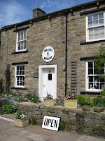
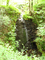
The Nuns’ Steps was a stone path going up through the woods. It was a very lovely walk through a quiet forest with wild garlic growing along the sides of the path. At the top we had great views looking across the fields. Our path from here was easy to follow, and fell into a routine of crossing field after field, with the occasional village. We stopped in Marske to have lunch in a grassy triangle in the middle of a road junction, and before leaving there we had a look around the church of St. Edmund the Martyr, which has been there since 1250.

View over Richmond

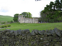
From Marske we crossed more fields, up hill and down dale, until finally about 2 pm we came out of Whitecliff Wood and there before us was a lovely view over the Swale valley, with Richmond Castle in the middle. The track led down into the town of Richmond, and as we walked into the built-up area we could hear an announcer’s voice. In a moment we found out that the announcer was calling out a cycle race which was taking place on the grass oval of the cricket club. We watched the final laps (the lad from Glasgow won in a sprint). In the market place there was a fun fair with rides, and nearby was a beer garden with loud music. All around were clumps of teenagers, many of whom had already been to the beer garden.

Bicycle race at Richmond fair

We were staying at the Old Brewery, which was at the bottom of a very steep hill right by the river. We went up to our room, which turned out to have a great view looking up to the castle. Although to get to it, you had to go through a room full of hotel laundry, then up the stairs at the back. Neil and Christine weren’t staying there, but they had forgotten where they had reserved, so they left their bags with us and went out to start looking. After settling in we walked back up the steep hill to have a look at the town. It was considerably larger than previous places we had stayed in, and a lot busier due to the fair. The castle dominates the south end of the town, and north of that is the old market square, now the business district. We went into the tourist information centre and bought a dish towel identifying breeds of sheep. We also inquired about Neil and Christine, and were told they had gone to the Black Lion hotel.

View from our window

Neil finally called at about 6 pm. They came down to pick up some of their things and told us about their problems. After calling almost everywhere in town, they had finally managed to get a room at the Black Lion. Christine claimed they had passed up the place which rented rooms by the hour. Then we went out to look for a place to eat dinner. That was almost as difficult, since all of the pubs were jammed full of drinkers and weren’t serving food. And we didn’t want to stand on the street eating fish and chips or pizza. But suddenly we found an Italian restaurant called La Piazza, upstairs. It had good food and luckily wasn’t full. As we left, we noticed that there were two other Coast to Coast groups there.

After dinner we parted ways with Neil and Christine. The police cars were arriving, so we headed back to our room to get ready for bed.

Elevation profile:

(click to enlarge)

May 25, 2008: Keld to Grinton YH

May 25, 2008

Keld to Grinton YH

(23.2 km; 7 hrs 57 min; 570 m ascent; 640 m descent)

Google Map

Our breakfast at the usual time of 8 am consisted of our usual fare of porridge, toast, and tea. We had packed up already so after settling our bill (₤102) we set off. Outside it was still partly cloudy and the wind was blowing as hard as ever. We had found there was a woollen shop down in Muker, not far away. But it didn’t open until 10 am, so we had to not hurry.

River Swale

We had decided to take a low level route which would take us down Swaledale. Following the foot path signs to Muker, the route was very lovely with both wildflowers and wildlife. We saw numerous bunnies, both dead and alive, and several varieties of primrose. We dawdled along and finally arrived in Muker at a suitable time. Rosemary bought a blue cardigan-style sweater with an elaborate lacy pattern around the bottom.

Swaledale Woollens

From Muker we headed back a bit, to the bridge over the Swale, and turned onto the path to Gunnerside. This route followed the river for quite a while, going through many squeeze stiles. In Gunnerside we stopped for tea and a toasted teacake at the Ghyllfoot Tearoom. Then we carried on, following the low-level option from Stedman’s book. This took us up quite steeply onto the open moor, with Lapwings flying about. The wind was still very strong and once again the going was slow and cold. We were glad we had not chosen the high-level option across the fells.

After that the route sloped downwards through small collections of houses which barely qualified as villages. The instructions were a little bit hard to follow, and eventually we found ourselves going steeply down rabbit-filled pastures that didn’t appear to have public rights of way. But we could see people walking on the road below us in the valley, so we climbed a gate and scrambled down to it. Once on the road we followed that for a while, then found a path leading to Reeth. That followed the Swale for quite a way before entering the outskirts of Reeth. While we were trying to locate ourselves on the map, one of the residents came over and told us how to get to the youth hostel in Grinton.

Squeeze stile

That route followed foot paths, then crossed to the south side of the Swale and headed up a very steep road. The walk was becoming much longer than we had expected. After the road left the houses and continued to climb through a moor, Rosemary sat down for a rest. Paul went up a bit farther to see what the large stone building on the left was. Sure enough, there was a small sign outside it saying that it was the Grinton youth hostel.

Grinton youth hostel

The hostel is a former shooting lodge at the edge of the moor. The layout is a bit Fawlty Towers-ish, with stairs of various lengths here and there and doors of various heights. We were in Room 13, which wasn’t mentioned in the signs on the wall. It was directly over the driveway into the courtyard.

Our room over the driveway

After checking in we had showers, then rinsed out some shirts and hung them up in the drying room. As we were going back from there, Neil and Christine arrived. They had travelled by bus and taxi from Robin Hood’s Bay. We chatted for a bit and then they went up to their room to get settled.

Dinner was at 7 pm. Both of us had chicken korma followed by chocolate fudge cake with cream. No sticky toffee pudding on the menu tonight, unfortunately.

Elevation profile:

(click to enlarge)