May 18, 2008
Ennerdale YH to Borrowdale YH
(16.9 km; 7 hrs 12 min; 680 m ascent; 715 m descent)
Google Map
Today started with blue sky. We had ordered our breakfast for 7:30 am, so we got up about 7 am. Today we had opted for the cold breakfast, except that Rosemary had hot porridge along with it. Once we had finished, we packed our bags and left at 9:10 am.

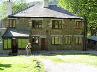
The first section had us walking along a dirt road through logging cutblocks. It was very reminiscent of British Columbia’s logging roads, except without fireweed. The road followed the River Liza as it climbed up the valley. After an hour or so we arrived at the Black Sail youth hostel, set in a lovely bowl surrounded by craggy mountains. The hostel was open, so we went in to have a look. It was built over 100 years ago; it was small, with one central room and two dorms. While there we had a pot of tea and some freshly-baked coffee cake.

Before long some other groups from High Gillerthwaite arrived. We had already decided we were not going to do the strenuous 600-metre climb over Red Pike, but after looking at the topo map it was clear that we would be climbing 300 metres from Black Sail anyway, so detouring up Scarth Gap to the top of the Haystacks would not be much extra climbing. We decided to do that.

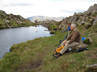
The going up was quite steep but fortunately only took an hour. At the top we decided to sit by the tarn and have lunch. By now it was clouding over and the wind was cold, so we put on our sweaters and sat in a sheltered spot. Despite the clouds, the views were still good. We could look down to Ennerdale Water and to the Irish Sea in one direction, and down into Buttermere in another. Altogether it was good that we had gone that way, because otherwise we would have missed the Buttermere view.

After going to the top of the Haystacks, we had to figure out where the route was. We headed east past Innominate Tarn (where the ashes of Alfred Wainwright were scattered) and soon lost the Sunday crowds. Following Stedman’s directions and following our GPS waypoints, we managed to find our way down. Soon we met up with the trail up from Black Sail, which carried on across the slope to the old tramway above Honister Pass. To get down to the pass, where there was a youth hostel and a slate museum, we walked down the very steep disused tramway. Then we followed an old toll road down into Seatoller, where we heard the first cuckoo of our walk.

Seatoller was a beautiful little village. From there it was only a short distance to the youth hostel in Longthwaite. The path ran right by the hostel, so we didn’t need to wander about trying to locate it. We checked in at about 4 pm and ordered our dinner, then sat in the lounge for a while. Dinner was at 7 pm and we were very hungry by then. Rosemary had beef cobbler and Paul had a chicken breast. And both of us had the sticky toffee pudding for dessert, of course.

After dinner we went out for a walk to look at Rosthwaite, a small village close to the hostel, and then down another road to Stonethwaite, an even smaller village. Collectively the three villages make up Borrowdale. Back at the hostel we sat in the lounge and wrote our journals, and also chatted with a couple of other walkers. Bedtime finally arrived about 11 pm.
Elevation profile:

