May 17, 2008
St Bees to Ennerdale YH
(31.3 km; 9 hrs 55 min; 894 m ascent; 768 m descent)
Google Map
We slept quite well, getting up about 7 am. It didn’t take us long to get our packs organized, then we went downstairs for breakfast. We both went for the Full English Breakfast: bacon, eggs, sausages, beans, toast, tomatoes, and mushrooms. Way too much food and we couldn’t eat it all.

After settling the balance of the B&B bill (₤50), we hit the trail at 8:10 am. The first part retraced our steps to the Irish Sea, and then climbed along the cliffs to the headland for good views. Luckily for us the weather was cooperating, with high grey clouds but no rain. This was much better weather for hiking than the sunny 25° weather they had recently been having in the north of England. And the wind on the cliffs was almost nonexistent, so walking was pleasant. We could just make out the Isle of Man in the distance, but couldn’t see Ireland.

The path followed the cliff for a considerable distance, passing bird observation points (guillemots and razorbills but unfortunately no puffins), St Bees Lighthouse, numerous sheep, and finally Birkham’s Quarry, before turning inland to Sandwith, a tiny hamlet. Following Henry Stedman’s Coast to Coast book we made our way along the narrow roads through Demesne, under railway tracks, into Moor Row, then into Cleator where we stopped at the Three Tuns pub for some tea to have with our lunch. Also at the pub was the group of six walkers who had also stayed at Stonehouse Farm. We had walked the morning section of the path about the same speed as them, alternatively behind them or in front of them. They were stopping in Ennerdale Bridge, so we would probably not see them after today.

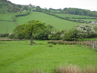
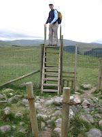
After lunch there was a bit more farm-walking, but then the terrain changed. We started up through a forestry plantation on the slopes of the notorious Dent Fell. After we left the road, the path led straight up, more steeply than we had expected, but before long we dragged ourselves up to the huge cairn, where we caught our breath. But that still wasn’t the top; it was only the place with the great view over the countryside we had just walked through and over the Irish Sea. The top was still higher, but it had no view and only a tiny marker.

The descent was much steeper than the ascent, which made us glad that we were walking from west to east. At the bottom there was some tricky route-finding, but eventually we made our way up Nannycatch Beck, a very lovely narrow valley with not much human activity. It was rather a long walk up to the top at Low Cockhowe, where we picked up the road down to Ennerdale Bridge.

By now it was getting late in the afternoon and we started to realize that the youth hostel was a long way beyond Ennerdale Bridge, and that we would not be getting there until about 6 pm. Once in Ennerdale Bridge we walked through the village and followed the roads to the end of the lake, where we had to put fresh batteries into the GPS.

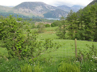
Our final leg of the day would be the long path along Ennerdale Water. It was rather stony, and we stepped carefully, hoping not to incur any injuries on our first day of walking. At the end of the lake there was a pair of Great Crested Grebes, and from there it was just a short walk across some pastures to the youth hostel at High Gillerthwaite, where we finally arrived at 6:10 pm, 10 hours after we had started from St Bees.

We checked in and went to our respective dormitory rooms. By the time we were settled in it was time for dinner. Tonight we were served an Indian meal with three kinds of curry. All in all it wasn’t bad. We were sitting at a table with a walker who seemed rather grumpy; it transpired that he had missed the group at the start of the walk, so he had walked at a great speed trying to catch them up, but still hadn’t found them. Then the hostel manager phoned around and found they were sitting in a pub in Ennerdale Bridge. No wonder he was grumpy.
Elevation profile:

