May 25, 2008
Keld to Grinton YH
(23.2 km; 7 hrs 57 min; 570 m ascent; 640 m descent)
Google Map
Our breakfast at the usual time of 8 am consisted of our usual fare of porridge, toast, and tea. We had packed up already so after settling our bill (₤102) we set off. Outside it was still partly cloudy and the wind was blowing as hard as ever. We had found there was a woollen shop down in Muker, not far away. But it didn’t open until 10 am, so we had to not hurry.

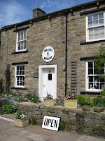
We had decided to take a low level route which would take us down Swaledale. Following the foot path signs to Muker, the route was very lovely with both wildflowers and wildlife. We saw numerous bunnies, both dead and alive, and several varieties of primrose. We dawdled along and finally arrived in Muker at a suitable time. Rosemary bought a blue cardigan-style sweater with an elaborate lacy pattern around the bottom.

From Muker we headed back a bit, to the bridge over the Swale, and turned onto the path to Gunnerside. This route followed the river for quite a while, going through many squeeze stiles. In Gunnerside we stopped for tea and a toasted teacake at the Ghyllfoot Tearoom. Then we carried on, following the low-level option from Stedman’s book. This took us up quite steeply onto the open moor, with Lapwings flying about. The wind was still very strong and once again the going was slow and cold. We were glad we had not chosen the high-level option across the fells.

After that the route sloped downwards through small collections of houses which barely qualified as villages. The instructions were a little bit hard to follow, and eventually we found ourselves going steeply down rabbit-filled pastures that didn’t appear to have public rights of way. But we could see people walking on the road below us in the valley, so we climbed a gate and scrambled down to it. Once on the road we followed that for a while, then found a path leading to Reeth. That followed the Swale for quite a way before entering the outskirts of Reeth. While we were trying to locate ourselves on the map, one of the residents came over and told us how to get to the youth hostel in Grinton.

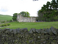
That route followed foot paths, then crossed to the south side of the Swale and headed up a very steep road. The walk was becoming much longer than we had expected. After the road left the houses and continued to climb through a moor, Rosemary sat down for a rest. Paul went up a bit farther to see what the large stone building on the left was. Sure enough, there was a small sign outside it saying that it was the Grinton youth hostel.

The hostel is a former shooting lodge at the edge of the moor. The layout is a bit Fawlty Towers-ish, with stairs of various lengths here and there and doors of various heights. We were in Room 13, which wasn’t mentioned in the signs on the wall. It was directly over the driveway into the courtyard.

After checking in we had showers, then rinsed out some shirts and hung them up in the drying room. As we were going back from there, Neil and Christine arrived. They had travelled by bus and taxi from Robin Hood’s Bay. We chatted for a bit and then they went up to their room to get settled.
Dinner was at 7 pm. Both of us had chicken korma followed by chocolate fudge cake with cream. No sticky toffee pudding on the menu tonight, unfortunately.
Elevation profile:

